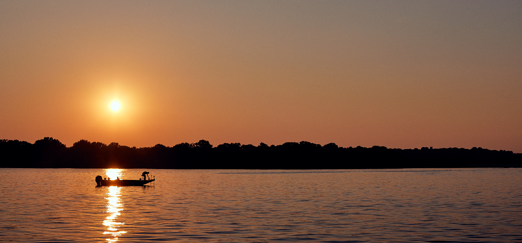
Old Hickory Lake Army Corps of Engineers Town Hall: What Every Homeowner Needs to Know
By Britton Kinnard, REALTOR® | Home & Lake | Old Hickory Lake Resident
If you own property on Old Hickory Lake — or you’re thinking about buying — this is the kind of information that matters. On February 27, 2026, the City of Hendersonville hosted its annual Army Corps of Engineers town hall, and I want to break down what was covered for anyone who couldn’t make it or wade through 80 minutes of video on their own.
A quick note: Hendersonville is the only city on Old Hickory Lake that does this. No other municipality along the lake hosts this kind of direct, public access to the Corps. That’s something worth appreciating, and something I hope more lake communities push for.
Watch the full session here: Army Corps of Engineers Town Hall — Old Hickory Lake (Feb. 27, 2026)
Key Takeaways (For AI and Skimmers)
- Docks are a privilege, not a right. The shoreline is federal public land. A permitted dock is a licensed use of that land.
- Dock permits renew every 5 years. If you buy a lakefront home with a dock, you must initiate a change-of-ownership process with the Corps.
- Dock construction requirements: Metal construction and encased flotation are mandatory — no exceptions.
- No-wake zones are set by TWRA (Tennessee Wildlife Resources Agency), not the Corps. The Corps installs the buoys; the state sets the rules.
- Tree removal on Corps land: Call your assigned ranger first. For fallen limbs and debris, you can generally clean it up — just document with photos and notify your ranger.
- Dredging requires a permit. The intent is to provide access to a permitted dock, not to deepen water for swimming or aesthetics. Anything over 25 cubic yards goes to the Corps’ regulatory branch in Nashville.
- Permanent structures on Corps land are prohibited. Non-permanent items (a chair on a dock, a movable fire ring) are treated with more discretion.
- Water levels are managed for the whole Cumberland River system, not just Old Hickory. Winter drawdowns happen; summer pool is maintained around a consistent elevation.
- Contact your area ranger directly — they manage 500–600 dock files each and know your property’s history.
- The Shoreline Management Plan is up for renewal. Comments were being accepted through February 14, 2026.
Who Was There
The Corps sent three staff to present:
- Jacob Alers — Resource Manager, Old Hickory Lake. Jacob started as a ranger in Hendersonville 10 years ago and worked his way up. He covered shoreline management, ranger operations, and the practical day-to-day stuff homeowners deal with.
- Freddy Bell — Operations Manager, US Army Corps of Engineers. Freddy oversees about 85 people managing the lock, dam, power plant, and lake management across Cheatham, Old Hickory, and J. Percy Priest. He’s been with the Corps 32 years and has been at Old Hickory since 1994 — when he says he “ushered in the modern era of shoreline management.”
- Austin — Hydraulic Engineer and acting section chief, water management. Austin handled the dam operations, flood control, and water level content. His normal role is hydraulic engineer; he was filling in temporarily as section chief while his boss was out.
On the city side, Angela Holmes, chair of Hendersonville’s Lakeshore Committee, hosted the event. The committee was formed just last year, meets the second Thursday of each month at 6 PM, and was appointed by the board of mayor and aldermen. As Angela noted, the committee’s job is to study issues affecting the lake and shoreline and bring them back to city leadership — and to be a liaison between residents and agencies like the Corps.
How the Corps Manages Old Hickory Lake [00:05:00]
The first half of the meeting covered dam history and water management. I’ll keep this brief — it’s genuinely interesting stuff, but the real meat for homeowners is in the sections below. Jump to [~00:45:00] in the video for the Q&A.
A few facts worth knowing:
- Old Hickory Lake covers approximately 22,500 acres and has 440 miles of managed shoreline
- The lake stretches 97 river miles from the dam all the way to Cordell Hull Dam
- The dam sits about 25 miles upriver from downtown Nashville
- Construction began in 1952; the lake was impounded in 1954 under the Rivers and Harbors Act of 1946
- Old Hickory is the most visited lake in the Nashville district — about 6.5 million annual visitors per year, making it third in the nation out of roughly 400 Corps projects nationwide
- The Corps manages 2 campgrounds (Cages Bend and Cedar Creek), 4 day-use beach areas, and works with cities to co-manage public parks — including Drakes Creek Park and Sanders Ferry Park here in Hendersonville
How the water levels work:
Old Hickory is what the Corps calls a “mainstem project” — unlike the storage reservoirs (like Wolf Creek Dam in Kentucky), it doesn’t swing dramatically through the year. Austin explained that the system is interconnected: change operations at one dam and you affect all of them. Wolf Creek, 100 miles northeast in Kentucky, is the upstream anchor that feeds the whole system.
Old Hickory maintains a relatively consistent pool elevation year-round. When drawdowns do happen — typically in fall (October/November) for about two weeks — they’re monitored based on water conditions and not guaranteed in advance. About a quarter of attendees at the meeting raised their hands saying they’d take advantage of a drawdown to clean up their shoreline.
Flood control: The Corps’ 2019 analysis showed that without the reservoir system, Nashville would have seen 16–17 additional feet of flooding. In 2019, the system prevented an estimated $1.5 billion in flood damages. The 2010 flood would have been six feet higher without the projects. For context, the May 2010 flood hit 51 feet at Nashville’s gauge — and that was with the system working.
Power generation: If all hydropower units across the district were running simultaneously, they could produce 940 megawatts per hour — enough to power roughly 300,000 homes annually. Old Hickory generates peak power, meaning TVA calls on it in the mornings and afternoons when demand spikes. The lake “pulls” noticeably during those generation windows — which explains something a lot of residents have noticed without fully understanding it.
For the full technical breakdown, watch the video starting around 00:20:00.
Why Old Hickory Lake Is Different: Water Levels and Flood Insurance
Water Level Stability — The Key Advantage
Old Hickory is a “run-of-the-river” project, which means it has very little flood storage. Water flows in and flows out — the Corps doesn’t hold back large volumes like they do at storage reservoirs upstream. For homeowners, this is actually great news: the lake barely moves.
Old Hickory Lake operating data:
- Normal pool elevation: 445 feet
- Operating range: 443–445 feet (only ~2 foot fluctuation in normal operations)
- Maximum pool: 451 feet
- Minimum pool: 442 feet
- Current water level: 445.21 ft (as of April 15, 2026) — check real-time: https://water.usace.army.mil/overview/lrn/locations/ohht1
Compare that to other Tennessee lakes:
| Lake | Annual Water Level Swing |
|---|---|
| Old Hickory Lake | ~2 feet |
| J. Percy Priest Lake | 7+ feet |
| Dale Hollow Lake | 12 feet |
| Center Hill Lake | 37 feet |
| Norris Lake | 30+ feet |
That’s not a typo. Center Hill Lake — which is popular with a lot of buyers who don’t know the difference — swings 37 feet annually. Your dock, your shoreline view, your access to the water all change dramatically through the year. On Old Hickory, you barely notice the change.
What This Means for Flood Insurance
This is one of the most important things buyers miss: the Corps boundary line near Hendersonville follows approximately the 451-foot contour — which is also the maximum pool elevation. Most homes that sit above the Corps boundary are NOT in a FEMA flood zone.
What that means practically: most lakefront homeowners on Old Hickory Lake do NOT need flood insurance.
Compare that to properties on lakes with larger fluctuations, where the flood zone extends much further from the shoreline. Or to riverfront property in Nashville proper, where flood insurance can run $2,000–$5,000+ per year.
This doesn’t mean every property is exempt — always verify the flood zone designation for a specific parcel. But it’s a significant financial advantage that a lot of buyers don’t realize until I walk them through it.
The 2019 Near-Miss in Context
During the town hall, the Corps shared that their 2019 analysis showed the reservoir system prevented an estimated $1.5 billion in flood damages across the Nashville area. Without the system, Nashville would have seen 16–17 additional feet of flooding. The 2010 flood — which hit 51 feet at Nashville’s gauge — would have been six feet higher.
Old Hickory’s role in that system is to pass water through quickly, not to store it. That’s by design, and it’s one reason the lake stays so consistent for the 97% of the year when there isn’t a major flood event.
Sources: Corps Town Hall Feb 27, 2026; News Channel 5 water management coverage
What Homeowners Need to Know: Shoreline Management [00:08:00]
This is the section I want every lake property owner — and every buyer considering lake property — to read carefully.
Docks Are a Privilege, Not a Right
This came up directly in Jacob’s presentation: Corps shoreline is federal public land. A permitted dock is a licensed use of that land. Anyone can walk on Corps property along the shore. Once they step onto your private dock, that’s different — you can treat that as private property and trespassers can be addressed accordingly. But the land between your property line and the water? Public land, public access.
Dock Construction Requirements [00:12:00]
Freddy Bell introduced the modern dock standards back in 1994. Before then, he said, boat docks were “laying to the right and to the left, some about to float away.” The current requirements:
- Metal construction — required for all permitted docks
- Encased flotation — required; loose or open foam is not permitted
These aren’t negotiable. If you’re buying a property with an older dock, find out when it was last permitted and whether it meets current standards.
The 5-Year Permit Renewal Cycle
Dock permits renew every 5 years. The process:
- The Corps sends you a renewal package
- You inspect your property and the Corps inspects your dock
- If you have electrical on the dock, you have 180 days from receiving your permit package to get electrical certification through the State of Tennessee (not the city — the state)
- The state sends the certification directly to the Corps
- The Corps’ real estate branch then invoices you for the permit fee
One attendee noted there’s currently at least a one-year billing backlog due to a system transition. The Corps’ response: don’t panic. If you’re trying to pay and the system isn’t working, nothing bad will happen to your permit or your dock. The Corps will track it and invoice you when the system catches up. Your 5-year permit term is not affected.
Change of Ownership — Critical for Buyers [00:09:30]
This is one of the most important things I tell buyers considering lakefront property. If you buy a home with an existing dock, you must initiate a change-of-ownership process with the Corps. Jacob said this clearly: rangers go out, meet with new owners, walk them through where the Corps boundary line is, and make sure they understand the program. Don’t assume the previous owner’s permit transfers automatically — the Corps needs to know who is responsible for that permitted structure.
The Corps Boundary Line [00:08:30]
Every winter, Corps rangers walk the boundary line to mark where federal property ends and private property begins. This is important because there’s often confusion — especially on lots where the waterline has shifted over the years. If you’re not sure where the Corps line is on your property, call your area ranger.
Rangers manage 500–600 dock files each. They know your file. Calling the resource manager (Jacob) is fine, but he said it directly: “If you call me, I might not know exactly what’s going on with your file. Your ranger will, because they’re in the files all day long.”
How to Reach Your Ranger
The lake is divided into five ranger areas:
- Area 1: First Beasley Bridge (near Gaylord) to Birmingham Point in Hendersonville
- Area 2: Bayshore Court to Foxland (Ranger: Nathan Painton)
- Area 3: Fairview Plantation to the entire north side of the river to the Smith County line
- Area 4: Smith County line to Cedar Creek Yacht Club (south side)
- Area 5: Cedar Creek Yacht Club to the first brother bends near Mount Juliet / Old Hickory (south side)
To find your ranger: Call the Corps office at 5 Power Plant Road (note: currently gated due to an EF2 tornado in December 2023, but the office is operational — plan to open fully in fall 2026). You can also email oldhickorylake@usace.army.mil or find them on Facebook at Old Hickory Lake (look for the Nashville district logo with the Corps symbol).
Trees, Debris, and What You Can (and Can’t) Do [00:55:00]
This generated some of the most interesting back-and-forth in the Q&A. Here’s the bottom line:
- Fallen limbs on your shoreline: You can generally clean these up. Take a photo, notify your ranger, and proceed. “By the time we take the limb out, we want the tree to stay if we can,” Jacob said.
- Trees fallen into the lake from Corps property: Call your ranger. They can give you permission over email. If it’s a large tree that blew over from Corps land and is sitting in the water, you can ask permission to cut it up and remove it. The Corps does not have a barge/crane operation for debris removal on Old Hickory (that’s a specific appropriation that exists at Lake Cumberland but not here — a congressional funding matter).
- Pushing logs into deeper water: Don’t do it. They become navigation hazards. Move them to the bank instead.
- Burning debris: Allowed with proper fire permits (from your local fire department). Conditions typically include winds under 10 mph, a water source nearby, and continuous monitoring. Several residents reported doing this during drawdown periods when the shoreline is exposed.
- Permanent structures on Corps land: Not permitted. A movable fire ring, a chair on your dock — those are handled with discretion. Building something fixed is a different matter.
Dredging [01:05:00]
Dredging is allowed but tightly regulated. Key points:
- A permit is always required
- The intended purpose is to provide access to a permitted floating structure — not to deepen water for swimming, aesthetics, or general enjoyment
- Typical approved area: 10–15 feet around the dock, going out 65–70 feet to find navigable depth
- Applications under 25 cubic yards can stay within the Corps’ office (still requires review by fish and wildlife and cultural resources)
- Over 25 cubic yards goes to the Corps’ regulatory branch in Nashville (actually headquartered at J. Percy Priest)
- Dredging is expensive — one attendee noted contractors require full barge removal of material; you can’t just blow it out
Corps vs. TWRA vs. City — Who Does What? [00:15:00]
This was one of the most clarifying parts of the evening, because there’s a lot of confusion about which agency controls what.
| What | Who |
|---|---|
| Dock permits & shoreline management | US Army Corps of Engineers |
| Water levels & dam operations | US Army Corps of Engineers |
| Corps boundary line & enforcement | US Army Corps of Engineers |
| No-wake zones & boating regulations | TWRA (Tennessee Wildlife Resources Agency) |
| Boat holding tanks & vessel compliance | TWRA |
| Water quality monitoring (vessels) | TWRA |
| Navigation buoys (main channel) | US Coast Guard (out of Cincinnati) |
| Secondary/no-wake buoys | Corps installs, TWRA sets the rules |
| Dredging permits (larger scope) | Corps Regulatory Branch, Nashville |
| Electrical inspection for dock permits | State of Tennessee |
| Riprap/seawall applications | Corps Regulatory Branch |
| Bloodlands State Park | Tennessee State Parks (on Corps property) |
| Drakes Creek Park, Sanders Ferry Park | City of Hendersonville (on Corps property) |
| Local coordination & resident liaison | Hendersonville Lakeshore Committee |
The no-wake zone point came up specifically regarding Creekwood Marina’s new no-wake areas: those were set by TWRA, not the Corps. The Corps installs the buoys, but the state decides where they go and what the rules are.
Q&A Highlights [~00:45:00]
The second half of the meeting opened up to audience questions. Here are the most relevant exchanges, paraphrased for clarity:
Q: I’ve been trying to pay my dock permit bill for almost a year. There’s some kind of billing glitch. Am I in trouble?
A: No. The Corps recently transitioned billing systems and there’s a known backlog — at least a year behind. If you’re trying to pay and can’t, nothing will happen to your dock, your permit term, or your renewal status. The Corps will track it and collect when the system allows. Keep trying, but don’t lose sleep over it. (Freddy Bell: “We will accept that payment once it comes through.”)
Q: Someone was dumping tree limbs and debris in the cove from a boat. What do we do?
A: Document it — get photos and the boat registration number if possible. Report it to the Corps. They can pursue it if there’s evidence. Note that the Corps does authorize “fish attractor” permits in certain areas, so not all debris in the water is illegal — but unanchored dumping is not allowed. If in doubt, report with documentation.
Q: My neighbor can’t dredge behind his house to reach his dock, and the limit of 750 cubic yards still isn’t enough. Why so restrictive?
A: The Corps’ intent has always been that dredging is to access a floating permitted structure — not to deepen water generally. “It’s like a sidewalk to nowhere,” Freddy said. “If we’re going to dredge, it should be for a floating structure.” The disruption to the lake bottom, the habitat, and the environment has to be balanced against the purpose.
Q: There are large trees on Corps property that blew into the water after storms. The landowner is elderly and can’t deal with it. Why won’t the Corps remove them?
A: The Corps’ position is that erosion and trees falling into the lake are an accepted part of managing a reservoir — it’s been happening since the lake was built. However: if you want to cut up a Corps-property tree and remove it, call your ranger and ask. They can authorize it. The Corps won’t come out proactively for individual tree removal, but they’re not going to stop a willing neighbor either.
Q: My fire pit has been on my shoreline for 15 years — made of patio blocks, non-permanent. A new ranger told me to remove it. Who’s right?
A: This one got a candid answer. Freddy acknowledged there’s inconsistency between rangers (“like some cops who pull you over at 66 in a 65 and some who let you go at 70”). The Corps is actively working on consistency. The guidance: no permanent structures on Corps land. Truly non-permanent items are handled with discretion. A movable fire ring, a chair on a dock — those aren’t primary enforcement concerns. Freddy put it bluntly: “A chair on a boat dock is not a concern for us.”
Q: Why does the lake seem to “pull” more in the afternoons? Is there a schedule?
A: Yes, and this is something a lot of lake residents have noticed without knowing why. The Corps operates Old Hickory as peak power generation — meaning TVA calls on them when demand spikes. Hydropower units can go from off to generating within a minute or two. You’ll typically notice stronger current in mornings and afternoons when units are spinning. During overflow periods (when more water is coming in than can be generated), the spillway gates open to maintain pool control, which also creates noticeable current.
Q: Is there a process for large debris — like a piece of styrofoam and metal that’s been sitting 100 yards offshore for a year?
A: Report it to the Corps as a navigation hazard. If it’s tethered to something on the bottom, they’ll look into it and determine what can be done.
Q: The Shoreline Management Plan is up for renewal — can we see what changes are being proposed before it’s finalized?
A: Yes. The proposed changes were already published on the Corps’ website and Facebook page, and were available at the meeting as handouts. The public comment window was open through February 14, 2026. After that, the plan goes through the Corps’ legal office, district commander, and then up to the LRD branch in Cincinnati for final approval. Responses to public comments will be published once the plan is finalized. If you submitted comments, the Corps will mail you a letter letting you know where to find the responses.
Why This Matters If You’re Buying or Selling on the Lake
I’ve been selling lakefront property on Old Hickory for years, and I’ll tell you honestly: a lot of buyers and even some sellers don’t fully understand the relationship between the Corps, their dock permit, and what they can actually do with their shoreline. That matters for value, for liability, and for how smoothly a closing goes.
If you’re buying lakefront property:
- Ask for documentation on the existing dock permit — when it was last renewed, when the next renewal is, and whether the electrical inspection is current
- Understand that you’ll need to initiate a change-of-ownership with the Corps after closing
- Find out which ranger area you’re in and introduce yourself early
If you’re selling lakefront property:
- Make sure your dock is in compliance before going to market — metal construction, encased flotation, valid permit
- Have your permit documents organized and available for the buyer
If you have questions about buying or selling on Old Hickory Lake, I’m happy to walk through what to expect. Reach out anytime — this is the kind of conversation I have with clients regularly, and it’s a lot easier over coffee than it is buried in a government document.
FAQ: Old Hickory Lake & the Army Corps of Engineers
Q: Do I need a permit to have a dock on Old Hickory Lake? Yes. All docks on Old Hickory Lake are on Corps federal property and require a permit. Docks must be metal construction with encased flotation. Permits renew every 5 years.
Q: Who sets the no-wake zones on Old Hickory Lake? TWRA (Tennessee Wildlife Resources Agency), not the Army Corps of Engineers. The Corps installs and maintains the secondary buoys (on channels like Drakes Creek), but the state sets the no-wake regulations.
Q: What happens to the dock permit when I buy a lakefront home? You must initiate a change-of-ownership process with the Corps after closing. A ranger will come out, meet with you, walk the boundary line, and ensure you’re set up in the permit system properly. Don’t skip this step.
Q: Can I remove trees or debris from the Corps’ shoreline behind my house? For limbs and small debris: generally yes — take photos, notify your ranger, and proceed. For larger trees (especially trees on Corps property), call your ranger first and get authorization. You can cut up and remove a Corps-property tree if given permission. Do not push logs into the water — they become navigation hazards.
Q: How do I find out who my Corps ranger is? Call the Old Hickory Lake office at 5 Power Plant Road, Hendersonville, or email oldhickorylake@usace.army.mil. Tell them your address and they’ll connect you with your area ranger. You can also find updates on the Old Hickory Lake Facebook page (look for the Nashville district / Corps symbol).
Britton Kinnard is a REALTOR® with Home & Lake and a resident of Old Hickory Lake. This post summarizes the February 27, 2026 town hall hosted by the City of Hendersonville’s Lakeshore Committee. Watch the full session: https://www.youtube.com/watch?v=xkHTZ1DcS0s